‹

Gyeyangsan Hiking

Incheon

HikingNight hiking2–3h

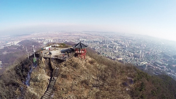
Three ways up Incheon's highest peak (395 m): the deck-stair trail from the Gyeyang Park office, the gentler museum and open-air stage route, and the forest climb from Yeonmujeong pavilion, plus the walk from Gyesan Station.
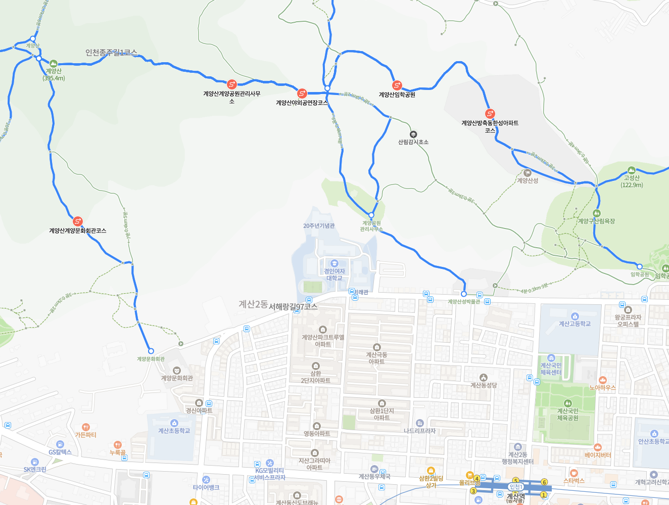
Gyeyangsan Hiking trail map
Naver Map: the Gyeyangsan courses and trailheads. Google Maps does not show these trails accurately.
  • Naver Map is more accurate to get to destinations. Each location has the link.
Open in Google Maps ↗

✨ About this walk

⛰️ Gyeyangsan is Incheon's highest mountain at 395 m, and the nearest proper hike from Gyesan Station on Incheon Line 1. Three trails climb it from the south-east, all ending at the octagonal pavilion on the summit.

The routes share the ridge trail for the upper part, so pick by the start: steep and quick, gentle and slower, or a forest climb. Each is 1.2 to 1.6 km and takes 40 minutes to about an hour and a quarter one way.

🚶 The route

  1. Route 1, Gyeyang Park Management Office (next to Kyungin Women's University): deck stairs the whole way, about 40 to 50 minutes. The fastest way up.
  2. Route 2, Gyeyangsanseong Museum and the open-air stage: the gentler start, about 1 h 15 min, joining the park-office trail after 350 m.
  3. Route 3, Yeonmujeong pavilion: a forest climb that meets the ridge trail after about 500 m, about 1 h to 1 h 10 min.
  4. Summit: Gyeyangsan summit and octagonal pavilion, open on all sides.
  5. From Gyesan Station exit 5 the museum is 0.7 km on streets and Imhak Park 0.9 km. A short connector links Yeonmujeong with Imhak Park past the forest bathing area.

💡 Good to know

  • 🚇 Getting there: Incheon Line 1 to Gyesan Station, exit 5, then 10 minutes on foot to the museum trailhead.
  • 🚻 There is one public toilet, just above the park-office trailhead. None higher up, so go before you climb.
  • 🔦 This is a night hike, so bring a torch or headlamp and keep your phone battery for the way down.
  • 👟 The deck stairs are steep but safe; sturdy shoes and water are enough.
  • 📍 Google Maps does not draw these trails correctly, so use the Naver Map screenshot under the map.
  • #Incheon
  • #Gyeyangsan
  • #NightHiking
  • #IncheonHiking
  • #DayTripFromSeoul
  • #GyesanStation
  • #HikingKorea
  • #KoreaTravel