‹

Jeju Olle Trail 18.1 (Chuja Island)

Jeju

Photo: Jeju Olle Foundation · CC BY-SA 4.0
Hiking1 day

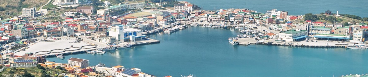
Route 18-1 on Chuja Island, the Olle trail's outlier an hour north of Jeju by ferry: 11.4 km from the township office over Bonggeulle-san, across Chuja Bridge, up Dondae-san and round the Yecho-ri cliffs to Sinyang Port, with the three stamp boxes, every toilet and first-aid kit, and the island's restaurants and harbour cafés pinned.

  • Getting to Chuja: ferries and the island day

    Chuja is about one hour by ferry from Jeju Port and is also served from Wando and Haenam on the mainland. Ferries are cancelled in high wind, so check the sailing the evening before and carry a day's margin if you have a flight. The route starts at the township office, 5 min from the pier, and ends at Sinyang Port on Lower Chuja, where the return ferry calls.

    General ferry pattern; timetables change by season and operator. Checked October 2026.
  • Naver Map is more accurate for navigation in Korea. Each location has the link.
Open in Google Maps ↗

✨ About this walk

🏝️ Chuja is the Olle trail's one outlier: 42 islands halfway between Jeju and the mainland, two of them joined by a bridge, with 1,700 people, a famous salted anchovy and almost no cars. Route 18-1 is the only way most visitors ever see it, and it is one of the best days on the whole trail.

11.4 km from the township office on Upper Chuja over the hill with General Choe Yeong's shrine, across the bridge to Lower Chuja, up Dondae-san for the view of the whole archipelago, round the wild east coast at Yecho-ri and down to Sinyang Port. Five to six hours with stops, more if you take the Navarone ridge.

🚶 The route

  1. Chuja-myeon Office: start stamp, toilets and the Olle information desk, 5 minutes from the ferry pier. The path climbs behind the village past the shrine of General Choe Yeong to Bonggeulle-san at the island's north-west tip.
  2. Back down through Sunhyogak and Chuja Cheosagak to the lighthouse road, then across Chuja Bridge to Lower Chuja and the rest area at its far end.
  3. Up the Eundal-san path to the lookout and on to Dondae-san, 164 m, the highest point of the islands and the mid-route stamp. Hallasan shows on a clear day.
  4. Down the school lane past the tiny Sinyang branch school and east around the headland: Yecho-ri Port, the cliff path and the grave of Hwang Gyeong-han, the martyr's infant son raised by islanders in 1801.
  5. South along the coast to Sinyang Port: end stamp, toilets in the ferry waiting room, and the harbour café for the wait.
  6. Toilets and first-aid kits are pinned in their own layer from the official Olle map; the stamp boxes in theirs; restaurants and cafés in pink, all checked on Naver.

💡 Good to know

  • ⛴️ Ferries from Jeju Port take about an hour; the day boat gives roughly six hours on the island, which is enough for the route at a steady pace. Staying a night in Sinyang or Daeseo-ri makes it a holiday.
  • 🍜 Eat by the pier before you start or at Sinyang at the end: grilled croaker and anchovy tables near the terminal, raw fish and a café on the hill above Sinyang Port.
  • 👟 Two proper climbs, Bonggeulle-san and Dondae-san, and exposed cliff paths on the east side. Trail shoes, sun cover and a wind layer; the island is windier than Jeju.
  • 🔗 Routes 5, 6 and 7 on this site cover the south coast of the main island if you want more Olle.
  • #Jeju
  • #ChujaIsland
  • #Chujado
  • #JejuOlle
  • #OlleTrail18
  • #IslandHiking
  • #Dondaesan
  • #JejuFerry
  • #KoreaTravel